Boots on the ground: A day in the field, discovering what the Natural Resource Management Expansion Program is doing for threatened species and biodiversity
On 11 March, we headed out to a property near Laidley, 3,250 ha bordering Main Range National Park, to see the Threatened Species Resilience Program in action. Detection dogs, nest box installations, weed management, fire planning and a fifth-generation farming family who are very much part of the solution.
It's a Wednesday morning on a property near Laidley, and there's a dog sniffing through the grass, two people up a tree, and a group of landholders, scientists and government representatives watching it all unfold. This is what investment into Natural Resource Management looks like on the ground.
The Crosby property sits on the edge of Main Range National Park, 3,250 hectares of land, home to approximately 1,400 species of flora and fauna, some of them threatened. According to iNaturalist data shared by Kate Crosby, Glynn's daughter, visitors to the property have logged over 4,500 observations on the citizen science platform, documenting the remarkable diversity of species. The Crosbys also run a program with local schools, getting kids off their screens and into the bush to learn about biodiversity and the natural world.
On 11 March, Healthy Land & Water brought together its project and communications teams, the Crosbys, and government partners for a field day showcasing the Threatened Species Resilience Program, one of three programs the organisation is delivering under the wider Queensland Government’s Natural Resource Management Expansion Program (NRMEP).
NRMEP is a $117.84 million investment into land and soil, water and biodiversity, under which Healthy Land & Water’s three projects (Threatened Species Resilience, Living Landscapes & Resilience and Urban Rewilding across South East Queensland) represent a combined $12.25 million commitment.
The Healthy Land & Water communications team was on the ground all day, capturing the work as it happened. Here's what we saw.
Why this property matters
The Crosby property shares a boundary with Main Range National Park, which makes it more than just a private cattle station. It's a buffer zone, and what happens on this land directly affects what happens inside the park.
The forest here is still maturing due to the property’s historic timber harvesting, and while it's healthy and full of food for fauna species, the trees simply haven't had the time to develop the natural hollows that species like Greater Gliders and Glossy Black-Cockatoos depend on for nesting and shelter. That's exactly what the nest boxes are here to address.
"The property where we are today is adjacent to Main Range National Park, which serves as a safe haven for many threatened species. Management actions on these properties significantly influence biodiversity and conservation outcomes and, if prioritised, can achieve landscape-scale results."
- Leonard Ainsworth, Environmental Project Manager, Healthy Land & Water
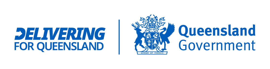
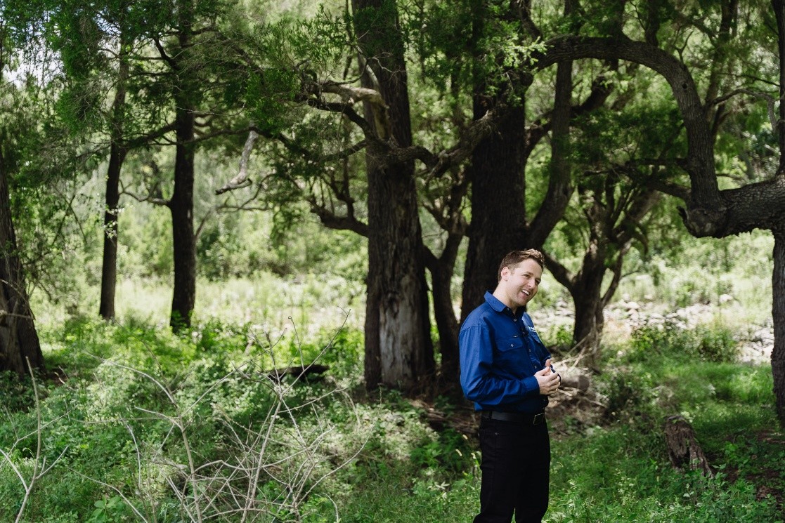 Photo: Healthy Land & Water’s Environmental Project Manager, Leonard Ainsworth. Credits: Joseph Bibadilla, Brown Fox Creative House.
Four species are the focus of this program: Koala, Glossy Black-Cockatoo, Brush-tailed Rock-wallaby, and Greater Glider. All are listed as vulnerable or endangered. All face the same broad set of challenges: habitat loss, invasive predators, altered fire regimes, and increasing climate pressure. The program is tackling each of these head-on.
 Photo: Model of the property showing the extent and features of the land. Credits: Joseph Bibadilla, Brown Fox Creative House.
NRMEP investment in action
In January 2026, Healthy Land & Water secured $12.25 million from the Queensland Government to deliver three major environmental projects across South East Queensland: Threatened Species Resilience, Living Landscapes & Resilience, and Urban Rewilding. Together they protect threatened species, restore waterways and landscapes, and strengthen biodiversity in urban and peri-urban areas.
The field day on the Crosby property was a window into what that investment looks like on the ground for the Threatened Species Resilience project, specifically, covering detection dogs, nest box installation, weed control, fire management plans, and the kind of long-term landholder relationships that make it all possible.
"Natural Resource Management investment is often talked about in environmental terms, but what it actually delivers is much broader. For landholders, this kind of funding provides access to expert support, tools, and on-ground works that improve soil health, water quality, and landscape resilience, outcomes that directly support productivity and reduce risk from things like erosion, flooding, and extreme weather."
- Julie McLellan, CEO, Healthy Land & Water
For Healthy Land & Water, this investment means being able to work at a scale that makes a real difference, connecting individual properties into a broader regional picture so that work done on properties such as the Crosbys' links up with efforts across South East Queensland.
"This funding isn't just about environmental outcomes. It's about future-proofing South East Queensland. It's an investment in resilience, in communities, and in ensuring the region can continue to thrive as it grows."
- Julie McLellan, CEO, Healthy Land & Water
 Healthy Land & Water’s CEO Julie McLellan interview. Credits: Joseph Bibadilla, Brown Fox Creative House
The dog that can smell what we can't see
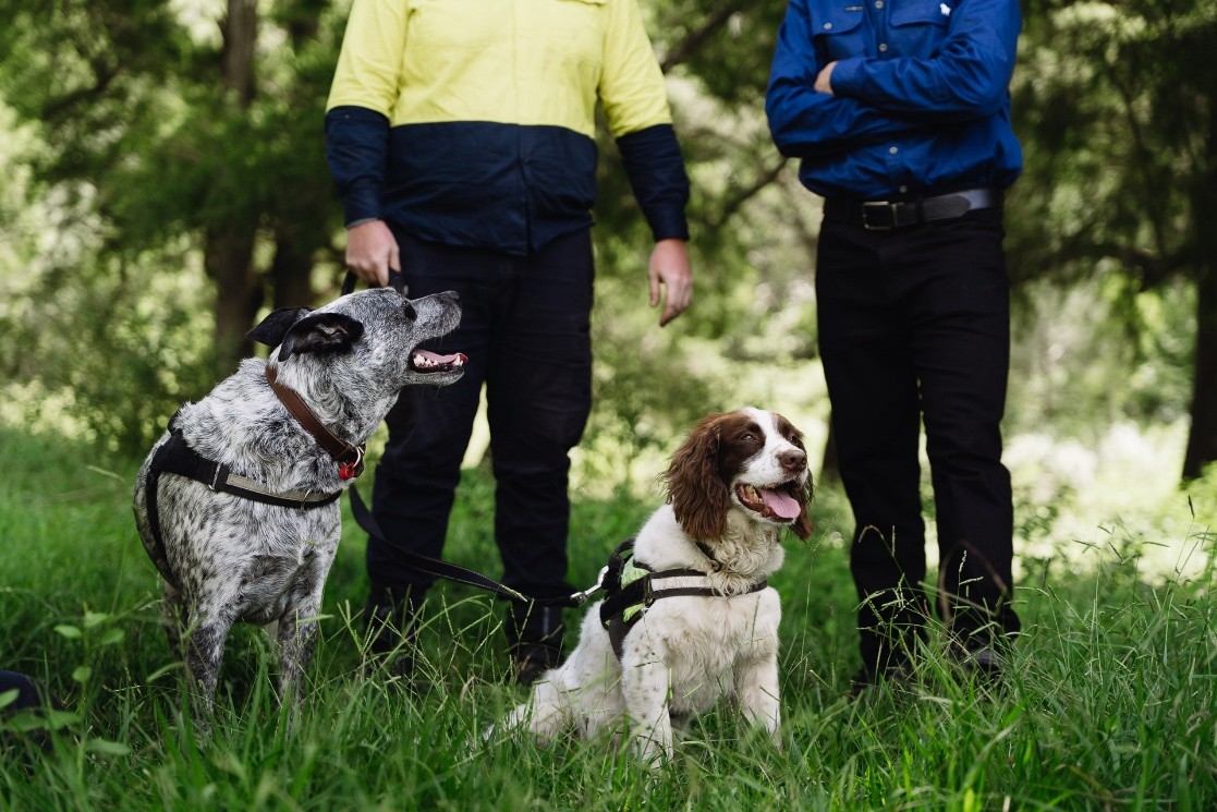
Mid-morning, Dennis Gannaway, owner of Bellden Environmental Services, took to the field with two dogs, demonstrating the program's scent detection work right where the group had gathered. Danny, an English Springer Spaniel, is a highly experienced scent detection dog trained to find seven distinct scent targets, including invasive species, threatened species and potable water. Arrow, a mixed-breed Cattle Dog, is younger and still in training, watching and learning. His focus will be on invasive species such as the European fox.
Danny’s primary target on this property is to locate feral fox dens. Foxes are a serious threat to species like the Brush-tailed Rock-wallaby. Locating and mapping dens and movement paths of invasive predators across the farm is the first step in developing a comprehensive management plan to reduce the threat posed by feral predators. The dogs will target eluvial planes, where denning activity is most likely, before moving up onto the hill slopes to ensure a consistent and comprehensive search of the property is completed. Searches are complemented by the placement of a field camera to capture the movement of targets where dogs have indicated on scent alone.
This program is funded by the Queensland Government and runs in collaboration with the Department of the Environment, Tourism, Science and Innovation, Local Government Authorities, Traditional Owners, and Landcare and community groups.